

MapSVG Interactive Maps Plugin
MapSVG Interactive Maps Plugin is a powerful WordPress solution that lets you turn images, vector files, and geographic maps into fully interactive, searchable maps. It is widely used for store locators, directories, real estate listings, and custom data visualization.
What is MapSVG Interactive Maps Plugin?
MapSVG is a WordPress mapping plugin that allows you to create interactive maps using vector files, images (JPEG/PNG), or Google Maps. It enables you to attach custom data to map regions or markers and display them dynamically on your website.
It also integrates with Google Maps to provide hybrid map functionality and real-world location data.
Key Benefits
Fully Interactive Maps
- Convert images or vectors into clickable maps
- Add dynamic regions and markers
- Create engaging visual experiences
Advanced Search & Filtering
- Search by location, category, or custom data
- Filter results instantly
- Ideal for directories and store locators
Flexible Data Management
- Attach custom fields to map objects
- Store text, images, dates, and more
- Connect with WordPress posts
Business & Store Locator Ready
- Find nearby locations by distance
- Perfect for multi-branch businesses
- Improve customer navigation experience
Features
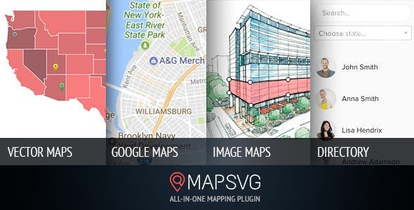
Multiple Map Types
- Vector maps
- Image-based maps (PNG/JPEG)
- Google Maps integration
100+ Prebuilt Maps
- Includes over 100 countries
- World maps included
- Ready-to-use templates
Custom Object System
- Create objects like stores, people, or listings
- Add custom metadata fields
- Link objects to WordPress posts
Advanced Search System
- Keyword search support
- Category filtering
- Distance-based search
Google Maps Overlay
- Combine vector maps with real-world maps
- Display hybrid interactive views
- Add address-based markers
Directory Integration
- Show map data in list format
- Sync list + map interactions
- Improve user navigation
Other Capabilities
- Supports custom map design from vector tools
- Works with floorplans and layouts
- Highly customizable UI
- Suitable for enterprise-level mapping solutions
Who Uses MapSVG Interactive Maps Plugin?
- Retail stores and franchises
- Real estate websites
- Travel and tourism platforms
- Event directories
- Educational and campus maps
- Service location businesses
Important Note
- Complex maps may require optimization for performance
- Large datasets can affect loading speed depending on hosting
- Google Maps features may require API key setup
- Custom vector maps require external design tools
- Best performance achieved with caching enabled
MapSVG Interactive Maps Plugin is one of the most advanced WordPress mapping tools available. It transforms static images or maps into interactive, searchable experiences, making it ideal for directories, store locators, and custom data visualization projects.

Reviews
There are no reviews yet.